Coastal web application
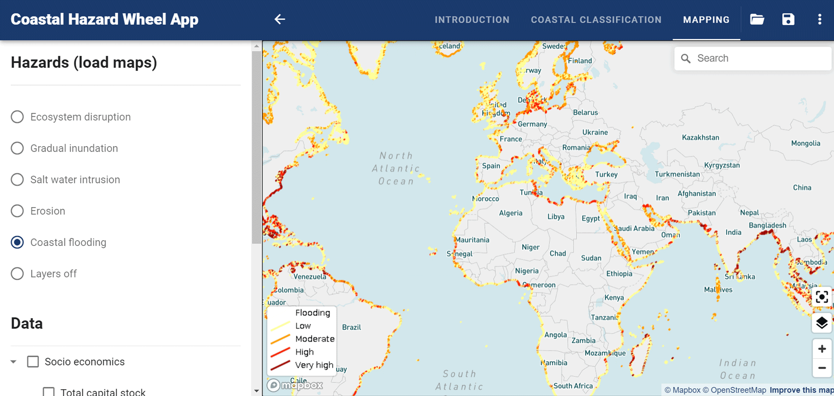
The Coastal Hazard Wheel App is freely available as a web application that can be accessed through regular web browsers. It currently provides global coastal classification information and automated adaptation guidance with a detail of about 200 meters for the site classification and 500 meters for the hazard mapping. The app makes use of the latest global geodata from remote sensing, on-site observations and modelling coupled with advanced IT-modules to classify the world's coastlines. Global and national classification information and adaptation guidance will become available with increasingly higher accuracy as various coastal classification and management projects are implemented.
Continuous R&D process
The Coastal Hazard Wheel App is undergoing continuous development and we aim to incorporate more detailed geodata as it becomes available and continuously refine the IT-modules behind the automated management guidance. Furthermore, research is currently carried out on the integration of broader coastal management activities and land-use and the addition of further adaptation and risk perspectives.
The Coastal Hazard Wheel App will constitute the backbone of the classification and automated adaptation guidance for the world's coastlines and all classification information will become available with open access.
The Coastal Hazard Wheel App can be accessed here and for further information on our ongoing research, development and classification activities, please get in touch with us.